This page is about case studies and locations in the project ‘Risks and Responses to Urban Futures’. For an overview, see the project homepage.
The project is working in two sites to the south and east of Delhi: Karhera Village in Ghaziabad District, and Yamuna Pushta, a flood plain on the banks of the river Yamuna.
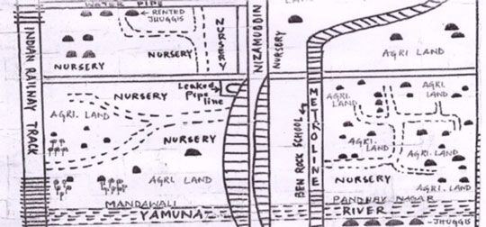
Detail from map of Yamuna Pushta
Work in the case studies involves collecting and analysing data from a wide range of sources, including:
- Original information collected through participatory mapping and interviews with community members to understand demands, flows and benefits from ecosystem services
- Secondary data on well-being, poverty and population (eg census)
- Biophysical data (e.g. land use/land cover, elevation, precipitation, water quality)
- Statistical and time-series analyses to indicate how physical and social elements change over time.
Update: September 2014
Following the projects inception workshop, scoping studies of both case study sites have been carried out and are being written up. They have been supported by a small-scale household census in Karhera and community meetings to introduce the project
Preliminary results show that considerable change that has taken place in Karhera over the past four years in livelihoods, ES and their degradation. In the Yamuna Pushta area, there is still much agricultural activity, but support from government and NGOs is poor; water & electricity and health services are virtually non-existent.
‘Top down’ mapping of ES stocks and poverty indicators based on satellite imagery and census data has begun for the Delhi NCR and for Hyderabad.
Following an exercise to map stakeholders and pathways to impact, our policy team is organising initial consultations with senior policy officials, and is carrying out empirical work in Ghaziabad to examine the policy and institutional arrangements impacting on ES.
In the following months, the project will move from scoping studies to fully-fledged data collection and participatory mapping.
Comparator sites
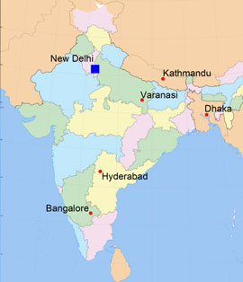 The project will work in parts of peri-urban areas around five additional cities (Hyderabad, Bangalore, Varanasi, Kathmandu and Dhaka). These will be mapped at coarser resolution and for a subset of ecosystem services.
These ‘comparator sites’ will be modelled using tools developed for Delhi. Using data from these 5 cities and Delhi, we will explore the use of narratives and quantitative models of the likely impacts of current (and future) policies on ES and dependent livelihoods.
We will also actively engage with initiatives in other south Asian cities, building a network with partners from other Indian cities and in Nepal and Bangladesh through project-linked activities. This network will facilitate the joint development of research approaches and tools for policy engagement that can be applied more widely.